
In anticipation of major storm flooding from a Category 3 Hurricane Harvey, Texas Governor Greg Abbott declared a state of disaster for 30 Texas counties Wednesday evening.
“Texans believe in taking action and always being prepared in the event of an emergency,” Governor Abbott said in a statement obtained by Breitbart Texas. “That is why I am taking every precaution prior to Tropical Depression Harvey making landfall. Preemptively declaring a state of disaster will allow Texas to quickly deploy resources for the emergency response effort in anticipation of the storm’s hazardous conditions.”
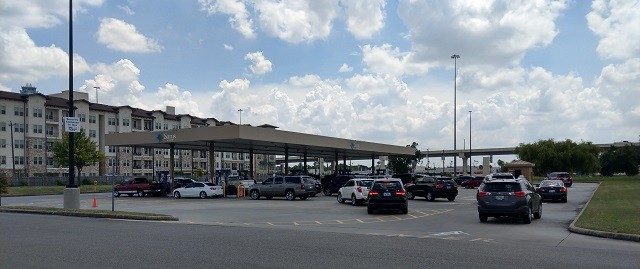
Lines forming at gas stations as Texans prepare for Hurricane Harvey. (Photo: Bob Price/Breitbart Texas)
The affected counties include: Aransas, Austin, Bee, Calhoun, Chambers, Colorado, Brazoria, DeWitt, Fayette, Fort Bend, Galveston, Goliad, Gonzales, Harris, Jackson, Jefferson, Jim Wells, Karnes, Kleberg, Lavaca, Liberty, Live Oak, Matagorda, Nueces, Refugio, San Patricio, Victoria, Waller, Wharton and Wilson Counties.
School closures are anticipated for Friday and perhaps Monday, depending on the path of the storm.
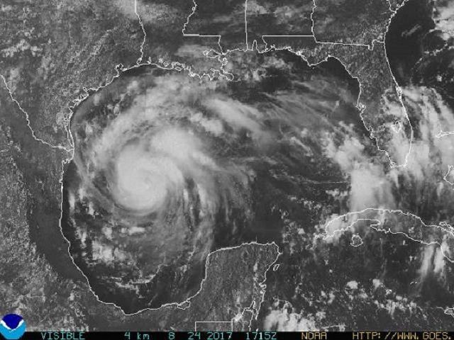
As of the 1 p.m. CDT report, Hurricane Harvey has maximum sustained winds of approximately 85 mph. The storm is located at latitude 24.4 North, longitude 93.6 West and is moving north-northwest at about 10 mph. Its forward speed is expected to decrease as the storm approaches the coast. Landfall is expected for late Friday night or early Saturday morning around Aransas Pass, Texas.
Hurricane-force winds currently extend 25 miles out from the center of the storm and tropical-storm-force winds extend 90 miles.
This will be the first major natural disaster for President Donald Trump.
STORM SURGE WARNING FROM NATIONAL HURRICANE CENTER:
The combination of a dangerous storm surge and the tide will cause normally dry areas near the coast to be flooded by rising waters moving inland from the shoreline. The water is expected to reach the following heights above ground if the peak surge occurs at the time of high tide…
N Entrance Padre Island Natl Seashore to Sargent…6 to 12 ft
Sargent to Jamaica Beach…5 to 8 ft
Port Mansfield to N Entrance Padre Island Natl Seashore…5 to 7 ft
Jamaica Beach to High Island…2 to 4 ft
Mouth of the Rio Grande to Port Mansfield…2 to 4 ft
High Island to Morgan City…1 to 3 ftThe deepest water will occur along the immediate coast near and to the northeast of the landfall location, where the surge will be accompanied by large and destructive waves. Surge-related flooding depends on the relative timing of the surge and the tidal cycle, and can vary greatly over short distances. For information specific to
your area, please see products issued by your local National Weather Service forecast office.
(Image: National Hurricane Center)
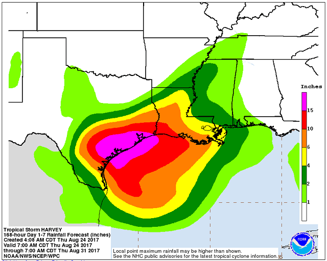
Rainfall totals are still expected to reach catastrophic levels with 12 to 20 inches of rain falling on the flat coastal region. Some spots can expect to receive 30 inches of rain.
Bob Price serves as associate editor and senior political news contributor for Breitbart Texas. He is a founding member of the Breitbart Texas team. Follow him on Twitter @BobPriceBBTX and Facebook.
COMMENTS
Please let us know if you're having issues with commenting.