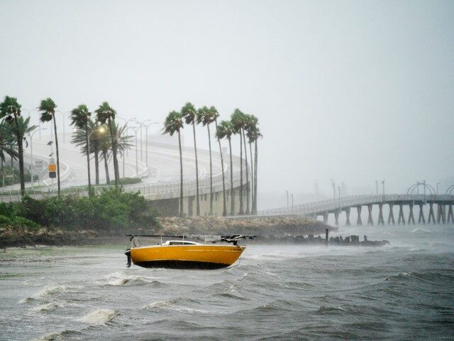
Florida officials are warning that Hurricane Ian is a “powerful major hurricane” that is very close to a Category 5 storm as it draws closer to the Sunshine State’s west coast.
As of Gov. Ron DeSantis’s 7:30 a.m. update, the storm was located roughly 80 miles south southwest of Charlotte County, with maximum sustained winds of 155 mph, making it a strong Category 4 storm. It is dancing close to a Category 5, which requires maximum sustained winds of 157 mph.
“It is now a category four hurricane with maximum sustained winds of up to 155 miles per hour,” he said during the press conference. “That is knocking on the door of a category five storm.”
WATCH:
Landfall is expected in southwest Florida on Wednesday as the storm moves across the state, projected to exit in northeast Florida.
The National Hurricane Center’s (NHC) 11 a.m. advisory has Hurricane Ian maintaining its status as a strong Category 4 hurricane with maximum sustained winds of 155 mph.
Additionally, it warns of “catastrophic storm surge inundation of 12 to 18 feet above ground level along with destructive waves” along the southwest Florida coastline “from Englewood to Bonita Beach, including Charlotte Harbor.” Catastrophic wind damage should also be expected along the southwestern coast of the state, but it adds that “hurricane-force winds are expected to extend well inland along the core” of the storm.
DeSantis assured that his team will continue to monitor the impacts of the storm, urging residents in its path to hunker down, as it is no longer safe to evacuate certain areas.
“There have been several tornado warnings issued during the overnight hours and we expect to see that continue today,” he said, warning of “catastrophic flooding and life-threatening storm surge on the Gulf Coast of Florida.”
“The highest risk areas are ranging from Collier County up to Sarasota County. The current track has the storm making landfall in Charlotte County. If you are in any of those counties, it’s no longer possible to safely evacuate. It’s time to hunker down and prepare for the storm,” he added. “This is a powerful storm that should be treated like you would treat if a tornado was approaching your home.”
Follow Breitbart News’s livewire for storm updates.


COMMENTS
Please let us know if you're having issues with commenting.